Rethinking Geography through an Indic Civilizational Lens
Introduction: What Does It Mean to Know a Place?
Geography is usually introduced to us as the study of the Earth: its landforms, rivers, climate, soils, vegetation, minerals, population and settlements. We learn physical geography and human geography, and eventually we are taught to examine the relationship between the two. This framework has enormous explanatory value. Yet, as I have worked more closely with questions of Indic knowledge systems, I have begun to wonder whether something fundamental is missing from the way geography is ordinarily taught.
The missing question is not simply where something is located. It is: what kind of relationship does a civilisation have with the place in which it lives?
This question changes the discipline considerably. Modern geography has often inherited a particular way of looking at the Earth. Land can become territory. Forests become resources. Rivers become water systems. Mountains become physical barriers. Minerals become reserves. Population becomes demographic data. Space becomes something that can be measured, mapped, administered and eventually exploited.
I do not reject these forms of knowledge. Maps are indispensable. Remote sensing is indispensable. GIS, climatology, hydrology, geomorphology and spatial statistics are indispensable. My concern is more fundamental: what happens when these instruments become the entire geographical imagination?
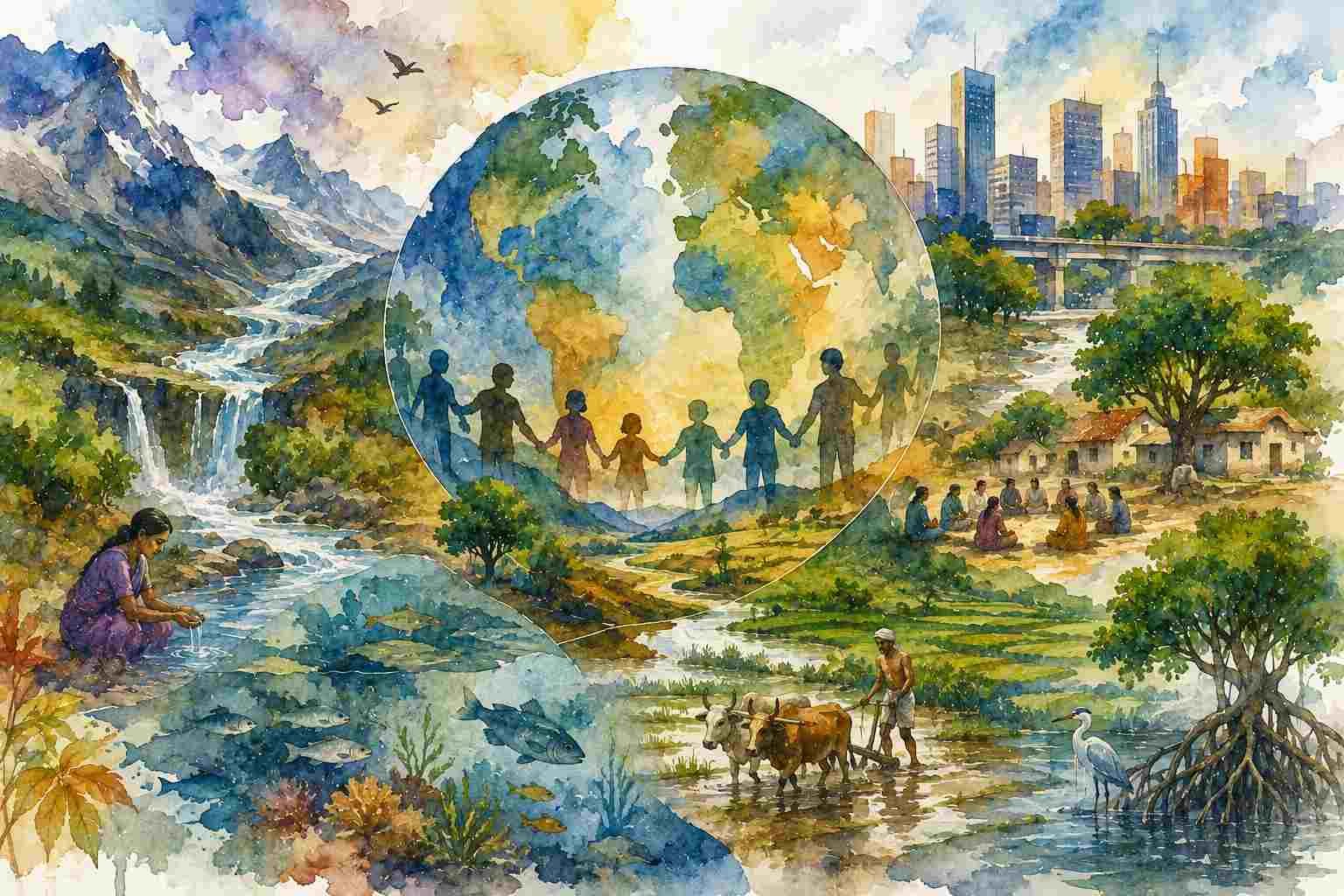
A Hindu civilizational understanding begins elsewhere. It does not begin, like the western academia, by assuming that human beings stand outside nature and then enter into a relationship with it. The human being is already situated within prakṛti. The Earth is not merely territory. She is Bhūmi, Pṛthivī, the sustaining ground of life. A river is not merely a channel through which water flows. It can also become mātā, a sacred presence, a civilizational axis, a source of livelihood, memory and tīrtha. A mountain is not merely elevation measured above sea level. It can become parvata, a sacred landscape inhabited by gods, sages, forests, rivers and pilgrimage traditions.
This is not a romantic rejection of geography. It is a different philosophy of geography.
The Colonial Gaze: When the Land Became a Resource
There is a historical reason why the language of “natural resources” became so powerful.
European imperial expansion required territories to be surveyed, classified, measured and administered. Mapping was therefore never merely an innocent intellectual exercise. Maps could determine boundaries, identify mineral deposits, classify forests, organise taxation and facilitate military control. A forest could be transformed from a lived landscape into a timber reserve. A river could become an irrigation potential. A mountain range could become a strategic frontier.
Colonial knowledge did not invent geography, but it gave geographical knowledge a powerful administrative orientation. This is why I think the word resource deserves more scrutiny than it normally receives in the classroom. The word itself is not wrong. Human beings certainly depend upon forests, water, minerals, land and animals. The problem begins when resource becomes the primary category through which we perceive the world. Once a forest is called a resource, we naturally ask how much timber it contains, how much revenue it can generate and how efficiently it can be extracted.
But a Hindu civilizational imagination would ask additional questions. What beings live there? What relationships sustain the forest? What sacred associations does the landscape carry? What knowledge of seasons, plants, animals and water has developed there? What obligations does human society have towards that landscape?
And perhaps the most important question: what happens to the wider order of life when we disturb it? The difference is subtle but profound. The first approach primarily asks what nature can provide to us. The second asks what kind of relationship allows both human society and the larger order of life to continue.
Pṛthivī Is Not Merely Land
One of the most striking examples comes from the Atharvaveda, particularly the famous Pṛthivī Sūkta (Atharvaveda 12.1).
The hymn does not speak about the Earth as an inert object waiting for human utilisation. It addresses Pṛthivī as a living and sustaining reality. It speaks of her mountains, rivers, waters, plants, settlements, animals and peoples. Most importantly, it expresses the relationship through kinship:
mātā bhūmiḥ putro ahaṃ pṛthivyāḥ
“Earth is my mother; I am her son.”
The verse is significant not because it gives us an ancient “environmental policy,” which would be anachronistic, but because it reveals an underlying civilizational orientation. The Earth is not conceptually reduced to property. The human being is situated within a relationship of belonging.
The same hymn invokes the Earth as the support of plants, animals and human communities and repeatedly connects human flourishing with the flourishing of the Earth. This is why I would hesitate to translate Pṛthivī simply as “land” in a curriculum built around Indic categories. Bhūmi, Pṛthivī, deśa, kṣetra, vana, nadī and tīrtha carry layers of meaning that cannot always be captured by modern geographical terminology.
The problem is not that modern geography is incorrect. The problem is that it is often insufficient.
Ṛta: Geography as Participation in Order
There is an even deeper idea behind this. Vedic thought does not imagine the cosmos as random matter. The concept of ṛta, the cosmic order, provides a way of understanding the interrelated functioning of existence. Human action is not isolated from this order. The Earth sustains life; water circulates; seasons return; plants grow; animals reproduce; human beings cultivate; communities organise; rituals and social obligations connect generations. Human civilisation exists within these cycles rather than outside them.
This is where the Hindu concept of dharma becomes relevant to geography. Dharma is not merely “religion” in the narrow modern sense. It concerns that which sustains, orders and regulates life. A geographical relationship therefore cannot be understood only in terms of possession and utilisation. It also involves kartavya—obligation.
If a river sustains a settlement, what does the settlement owe the river? If a forest sustains a community, what does the community owe the forest? If soil sustains agriculture, what obligations follow from dependence upon soil? These are not merely environmental questions. They are questions of dharma.
From Bhoga to Responsibility
The Īśāvāsya Upaniṣad offers another important philosophical foundation:
īśāvāsyam idaṃ sarvaṃ yat kiñca jagatyāṃ jagat
tena tyaktena bhuñjīthā mā gṛdhaḥ kasya svid dhanam
The world is presented as pervaded by Īśa, followed by the injunction not to covet another’s wealth. The verse has been interpreted in different ways within the Vedāntic traditions, and I would not reduce it to a modern environmental slogan. Yet its philosophical implication is powerful: the world is not presented as morally empty matter available for unlimited possession.
This gives us an important corrective to a purely extractive understanding of geography. The question is not whether human beings may use nature. Of course they must. Human life itself depends upon use. The question is whether bhoga is separated from dharma.
A civilisation that knows only consumption eventually forgets the conditions that make consumption possible. The Hindu intellectual tradition repeatedly returns to this relationship between enjoyment, restraint, obligation and order. That is a much richer foundation for geographical thought than simply telling students to “protect the environment.”
Geography Is Also the Geography of Sacred Space
One of the most distinctive features of Hindu civilisation is the manner in which geography itself becomes woven into sacred memory. The Ganga is not simply a river. Kashi is not simply an urban settlement. Himalaya is not simply a mountain system. Kurukṣetra is not simply a geographical location. Prayāga is not simply the confluence of rivers. Rāmeśvaram, Badrināth, Kedarnāth, Jagannātha Purī and countless other places cannot be adequately understood by their latitude and longitude alone.
They are sacred geographies. Pilgrimage creates relationships between places. Stories create civilizational memory. Temples anchor sacred presence. Rivers connect regions. Festivals connect communities. Tīrtha-yātrā turns geographical movement into a civilizational practice. Diana Eck’s work on India’s sacred geography has demonstrated how pilgrimage, sacred places and geographical imagination have helped construct a civilizational sense of connected space across the subcontinent.
This is important for geography because it tells us that space is not experienced only physically. A landscape can have ecological, economic, political, historical and sacred dimensions simultaneously. Modern geography has tools for measuring the first several. A Hindu geographical imagination insists that the sacred dimension cannot simply be dismissed as irrational residue.
Kṣetra: A More Meaningful Geography of Place
The concept of kṣetra is particularly useful for rethinking geography. Kṣetra literally refers to a field or cultivated area, but its intellectual use extends far beyond agricultural land. In the Bhagavad Gītā, the body itself becomes kṣetra, the field, while the knower is kṣetrajña (Gītā 13.1–2).
This is an extraordinary metaphor for geographical thinking. A field is not merely an area enclosed by a boundary. It is a space in which relationships operate. Soil, water, seed, labour, season, animal life and human intention interact. Similarly, a geographical region is not simply a polygon on a map.
It is a field of relationships. This allows us to move beyond the sterile opposition between “nature” and “society.” The real geographical question becomes: what relationships produce a particular form of life in a particular place?
- Why did a settlement emerge here?
- Why did a particular crop become important?
- Why did a pilgrimage route develop?
- Why did a community develop particular occupations?
- Why did a particular river become both economically important and sacred?
These questions are geographical because they concern the interaction of deśa, kāla, human practice and the larger order of life.
Kauṭilya: Indic Statecraft Was Not Geographically Blind
This relationship between geography and governance is also visible in the Arthaśāstra. Kauṭilya does not describe territory merely as an abstract sovereign possession. His political geography includes agriculture, pasture, irrigation works, roads, settlements, mines, forests, elephant forests and places of pilgrimage.
The text instructs the ruler to establish and maintain reservoirs, roads, settlements, groves and forests. It also distinguishes different categories of forests, including forests for produce and specially protected elephant forests. The treatment of elephant forests is particularly revealing. Kauṭilya describes administrative officers responsible for their protection and explicitly prescribes severe punishment for killing elephants in these protected areas. The forest is therefore simultaneously ecological space, economic space, strategic space and administrative space.
This does not mean that the Arthaśāstra was an environmentalist text in the contemporary sense. It was not. Kauṭilya was a realist political thinker, and forests were also sources of revenue, materials and military resources. That is precisely why the text is interesting.
Indic thought did not solve the relationship between nature and human use by pretending that resources had no economic value. Instead, it recognised multiple functions of the same geographical space. A forest could produce wealth and still require protection. An elephant could have military value and still belong within a protected forest regime. Water could support agriculture and simultaneously require state investment and maintenance. This is a far more sophisticated starting point for an Indic geography than the simplistic claim that “ancient Indians lived in harmony with nature.”
The Limits of the “Natural Resource” Category
Consider a river again.
A modern geographical survey may measure its discharge, basin, gradient, sediment load and seasonal variation. These measurements are indispensable. But a Hindu community may experience the same river as a source of tīrtha, livelihood, ritual, memory, agriculture and identity. Neither perspective has to cancel the other. The mistake is to assume that only the first qualifies as knowledge.
Likewise, a forest can be studied through satellite imagery, biodiversity indices and carbon calculations. But people living within that landscape may possess knowledge about medicinal plants, seasonal migration, water sources, animal behaviour and changes in vegetation that cannot simply be extracted from a satellite image. I therefore prefer the idea of knowledge of place over the narrow idea of resource mapping. The former allows multiple forms of knowledge to enter the conversation.
From Land to Relationship, From Relationship to Dharma
This is where I would redesign the basic pedagogical progression of geography.
The conventional sequence often looks something like: Land → Resource → Utilisation → Management
I would propose an Indic expansion: Bhūmi → Kṣetra → Relationship → Dharma → Responsibility
Bhūmi asks us to recognise the Earth as the ground of life. Kṣetra asks us to understand a place as a field in which multiple relationships operate. Relationship asks us to understand how humans, animals, plants, water, soil, settlements and institutions interact. Dharma asks what obligations arise from those relationships. Responsibility asks what human action should follow from that understanding. This does not require throwing away physical geography. It requires placing physical geography inside a larger civilizational understanding of life.
A Hindu Geography Is Not an Anti-Science Geography
I want to be particularly clear about this because Indic thought is often placed unnecessarily into opposition with modern science. I do not believe a decolonised geography should reject GIS, remote sensing, climate science, satellite mapping, demographic analysis or spatial statistics. These are powerful instruments.
What I question is the assumption that measurement exhausts meaning. A satellite can show deforestation. It cannot by itself explain the entire cultural relationship between a forest and the people who inhabit its surrounding region. A GIS layer can map a pilgrimage route. It cannot fully explain why generations of people considered that journey sacred. A hydrological model can calculate river discharge. It cannot by itself explain why a river became a civilizational mother. Scientific instruments tell us something important about the world. Civilizational knowledge asks what that knowledge means for how we live.
We need both.
Reading Bharat as a Geographical Civilisation
This becomes especially important when studying Bharat. Bharat is not merely a political territory drawn upon a modern map. Its civilizational geography has been produced through relationships among rivers, mountains, forests, settlements, pilgrimage routes, sacred places, trade networks, cultural memories and communities.
The geographical imagination of Bharat is therefore simultaneously physical and civilizational. The Himalaya is connected to the imagination of Śiva. The Ganga carries geographical, historical and sacred meanings. Kurukṣetra carries the memory of the Mahābhārata and the Bhagavad Gītā. Ayodhyā, Mathurā, Kāśī, Avantī, Kāñcī, Dvārakā and countless other places participate in a sacred geography that cannot be understood merely by treating them as urban settlements.
The tīrtha tradition effectively creates a civilizational network across space. Geography becomes memory, memory becomes pilgrimage, pilgrimage becomes relationship, and relationship contributes to civilizational continuity. This is why I think Bharat should not merely be studied geographically; Bharat should also be read geographically through its own categories.
What Should a Decolonised Geography Curriculum Look Like?
A genuinely decolonised geography curriculum should therefore do more than add a few Sanskrit words to an existing textbook.
It should ask different questions. Students should learn rivers not only as drainage systems but also as civilizational systems. They should study forests not only through timber and biodiversity but through livelihoods, local knowledge, sacred traditions and state institutions. They should study mountains not merely as relief features but also as ecological and sacred landscapes. They should study settlements through deśa, kāla, occupation, water, agriculture, mobility and cultural memory. They should examine colonial surveys and mapping as technologies of knowledge and administration. They should study modern spatial science without assuming that modernity possesses the only legitimate vocabulary for understanding space.
Most importantly, they should learn to distinguish between owning a place and belonging to a place. The former is a question of property. The latter is a civilizational question.
Geography as a Dhārmic Discipline
Perhaps this is where my own thinking about geography ultimately leads.
I do not want to replace Western geography with an equally rigid “Hindu geography.” That would simply reproduce the problem in reverse. What I want is more ambitious: to recover categories that allow us to ask questions modern disciplinary boundaries often prevent us from asking.
A Hindu approach begins from the recognition that existence is relational. The human being is not an isolated consumer. The Earth is not merely an object. Nature is not merely raw material. Place is not merely coordinates. The landscape is not merely scenery. And knowledge is not merely information extracted from an external object.
The Pṛthivī Sūkta gives us the language of Mother Earth. The Īśāvāsya Upaniṣad gives us the discipline of non-covetousness and an understanding of a world pervaded by Īśa. The Bhagavad Gītā gives us kṣetra and kṣetrajña. Vedic thought gives us ṛta. Dharmaśāstric and political traditions give us obligations concerning land, boundaries, agriculture and social order. Kauṭilya demonstrates that governance itself requires detailed geographical intelligence concerning forests, water, agriculture, settlements and animals.
Taken together, these traditions do not give us a ready-made modern environmental policy. Nor should we force them into one. They give us something more foundational: a different way of asking what it means to inhabit the Earth. That, in my view, is where a genuinely Indic geography can begin. The question is no longer simply: “What resources does this region contain?”
It becomes: “What relationships sustain life in this region, what dharma arises from those relationships, and what happens when we violate them?”
That is a geographical question. But it is also a Hindu question. And perhaps that is precisely what contemporary geography has forgotten: we do not merely occupy the Earth. We participate in a living order that precedes us, sustains us and will continue after us.
References
- Atharvaveda. Pṛthivī Sūkta, 12.1. Ralph T. H. Griffith, trans. The hymn describes Pṛthivī through her waters, plants, animals, peoples and sustaining power, including the celebrated formulation, “Earth is my mother; I am her son.”
- Eck, Diana L. (2012). India: A Sacred Geography. New York: Harmony Books.
- Kauṭilya. Arthaśāstra. Book II, especially chapters concerning the formation of villages, division of land, forests, irrigation works and elephant forests. The text explicitly distinguishes forests for produce, protected elephant forests and other categories of managed geographical space.
- Manusmṛti. Chapter VIII, especially verses 245–247, concerning the demarcation of village boundaries through trees, shrubs, bamboo and other natural markers.
- The Bhagavad Gītā. 13.1–2, on kṣetra and kṣetrajña.
- The Īśāvāsya Upaniṣad. Mantra 1: īśāvāsyam idaṃ sarvam… tena tyaktena bhuñjīthā mā gṛdhaḥ kasya svid dhanam. The verse has generated different interpretive traditions, but its central vocabulary directly challenges an unrestricted conception of possession and covetousness.
- Sharma, Arvind. (1991). Modern Hindu Thought: The Essential Texts. Oxford University Press.
- Thapar, Romila. (2002). Cultural Pasts: Essays in Early Indian History. Oxford University Press.
- Eck, Diana L. (2012). India: A Sacred Geography. The work is particularly useful for understanding how pilgrimage and sacred places produce a geographical imagination that connects otherwise distant regions of the subcontinent.